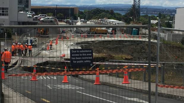
Despite recent torrential rain, the Auckland landslide that swallowed a Birkenhead car park has stabilised and plans for the future of the area are being considered.
Auckland Council’s geotech lead Ross Roberts said there had been very small scale movement since the sheet piles were put in, over the New Year period.
So far, the slip was behaving as the council wanted it to, Roberts said.
The community was now being asked what they wanted the land to be used for in the future. But this did not mean that the council was opposed to turning it back into a car park.
“Lots of things could be done,” Roberts said. “If we can use it to improve things, then we should.”
Submissions for community input closed February 20 and Auckland Council was collating the feedback, Rawene Landslide Project communications lead Amanda Blakey said.
A number of things were happening with the site, including resource consents, iwi consultation, as well as the ongoing consultation with Birkenhead community.
But, a definitive directive regarding the future use of the site is still “some way off yet”, Blakey said.
Chairman of the business association Pete Taylor said that, in the wake of the car park slip, Birkenhead had created a lot of other parking in the village.
Taylor said the stabilisation news was good for land and business owners’ peace of mind and if businesses got the parking back, that would be a bonus.
“But, if it’s something else, then that’s okay too. They are making headway – and it’s working.”
Meanwhile, the Earthquake Commission (EQC) announced in media release it was putting funding towards new technology to monitor how the land was moving on 10 slopes in different parts of Auckland. Birkenhead was one of these sites.
EQC general manager resilience Dr Hugh Cowan said research on landslides was very important for New Zealand.
“Most years, EQC gets more claims for landslide damage than any other natural hazard,” Cowan said.
The new technology would provide valuable data for Auckland Council on the specific research sites, and would help develop a cost-effective way for any council to map the stability of slopes.”
Article by Laine Moger
Published 28 February 2018 > North Shore Times – stuff.co.nz